First western snow, with 8+ inches, should help to quash fires
by Meteorologist Joel Gratz
Welcome back to winter!
Well, winter isn’t here just yet, but the weather map is lighting up with a couple of storms during the next two weeks, so it’s time to talk about snow.
Just seeing early-season flakes is reason enough to get excited, and a side benefit of the upcoming storms will be a reduction in the spread of ongoing wildfires.
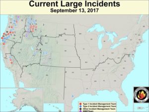
This is a map of current fires, with the most burning in the northwest and the northern Rockies.
Thankfully, the upcoming storms will mostly target the same areas that have been hardest hit by the fires. This map shows the precipitation for the next two weeks compared to average. The green areas show above average precipitation – exactly where most of the fires are burning.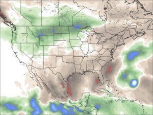
The first storm will bring snow to the northwest and northern Rockies late this week and into the weekend. The snow level might dip down to 6,000-7,000 feet, and the higher elevations of Montana and Wyoming could measure 8+ inches.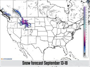
What’s better than one storm?
A series of storms!
And that’s what longer-range models show.
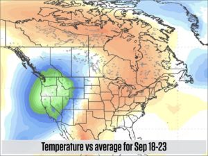
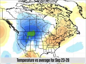
Expect to see cooler-than-average temperatures over the northwest and the northern Rockies through almost the end of the month.
Along with this cool air, we should see additional storms, but a forecast of temperature trends is more accurate than a forecast of snow accumulation, especially 7-10 days away, so that’s why I showed the temperature forecast maps above.
In terms of timing, the next storm will likely roll through the west between about September 19-23.
I’ll be back next week with a few pictures of snowy peaks.
In the mean time, happy powder dreams!
JOEL GRATZ
Did you know that you can get more from OpenSnow?
If you’re looking for a way to support OpenSnow and get access to more data, consider signing up for the All-Access Pass.
- 10-day forecasts
- Custom alerts to know about upcoming powder days
- Time-lapse webcams for tracking exactly when fresh snow has fallen
- Email delivery of the US and Canada Daily Snow as soon as it’s published
All of this costs just $19 for one full year (365 days) and helps to support OpenSnow so that we can spend money and time to further improve our website and mobile apps.
I’d love to count you as an All-Access member!
Posted from OpenSnow.com

